|
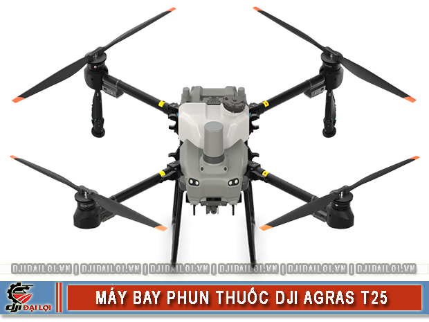
SPECIFICATIONS |
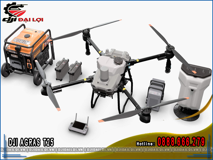
DJI AGRAS T25 |
|---|---|
|
Dimensions (Unfolded) |
2585 × 2675 × 780 mm |
|
Drone Body Weight |
25.4 kg (excluding battery) |
|
Spray/Spread Payload |
20 kg (spraying) – 25 kg (spreading) |
|
Tank Capacity |
20 L (spray tank) – 35 L (spread tank) |
|
Maximum Spray Rate |
24 L/min (with 4 centrifugal nozzles), 16 L/min (with 2 nozzles) |
|
Droplet Size |
50–500 microns (adjustable) |
|
Obstacle Avoidance Sensors |
Dual Phased Array Radar + Dual Vision Sensors (360° scan, terrain mapping) |
|
Average Flight Time |
~7 minutes (with payload), ~14 minutes (without payload) |
|
Control System |
DJI RC Plus, 7” display, 7 km range (O3 Pro), 8-core processor |
|
Fast Charging & Power Supply |
DB800 battery charges in 9–12 minutes via C8000 + D6000i generator (6000W) |

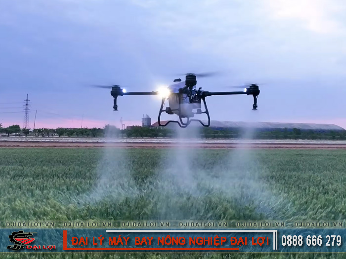
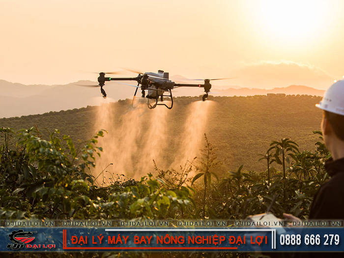
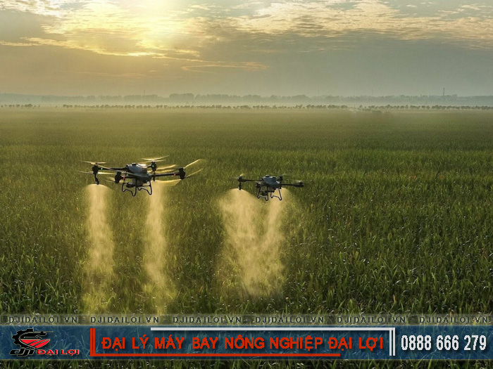
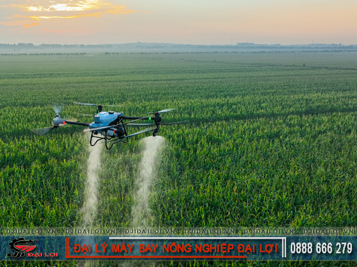
The T25 agricultural drone can spray up to 20kg and spread up to 25kg of dry granular materials. Its large tank system combined with a high spray flow rate boosts working efficiency across various crop types - from rice paddies to fruit orchards.
Two spraying modes:
Benefits: uniform misting, fine droplet size, reduced chemical waste and drift loss.
Enhanced spreading system includes:
Built-in real-time weight sensor allows accurate tracking of remaining materials - no manual checks needed.
The DJI T25 uses a dual centrifugal spraying system and high-power magnetic pumps that create ultra-fine droplets with zero leakage, ensuring precise and efficient application across all crop types.
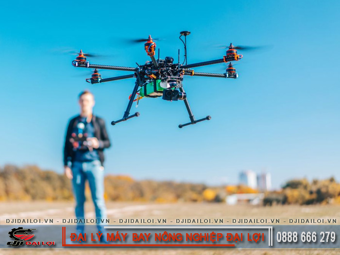
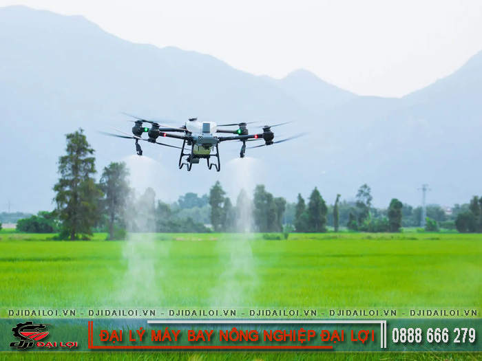
The DJI T25 agricultural drone integrates multi-layered sensors, including dual phased array radars and binocular vision systems, ensuring full safety during complex terrain flights, orchards, and obstacle-rich environments.
The T25 uses a gimbal FPV camera and smart 3D mapping system to quickly survey orchards and fields, automatically planning flight paths tailored to each area.
Built-in high-res gimbal camera with adjustable angles for complete area scanning.
Automatically collects data to:
In flat terrain, the T25 can map up to 13.3 ha in just 3–10 minutes.
The system detects:
Farmers save time by avoiding manual planning or trial flights.
The DJI T25 is operated via the DJI RC Plus controller and the DB800 battery, which charges in just 9 minutes. The O3 Pro transmission and D6000i generator ensure stable operations even without power grids.
More than just a spraying drone, the T25 acts as a digital agriculture data hub. It connects with the Mavic 3M drone to collect multispectral data, create 3D maps, and auto-plan zone-specific operations.
All mapped data is processed into automated spray/spread routes.
System supports:
Result: less manual labor, fewer errors, improved productivity for farms and agribusinesses.
The full set of the official DJI T25 spraying drone starts at around 239 million VND, depending on included accessories like batteries, chargers, and spreader kits. Prices vary based on time and promotion.
|
Equipment |
Price (VND) |
|---|---|
|
DJI T25 Drone (RC Plus) |
129,200,000 |
|
DB800 Smart Battery |
27,500,000 |
|
D6000i Generator |
38,000,000 |
|
C8000 Smart Charger |
23,000,000 |
|
T25 Spreader System |
13,860,000 |
|
Dual Nozzle Sprayer Kit |
8,430,000 |
|
DJI Terra Account (1 Yr) |
Free |
Note: Prices are for reference and may change based on market conditions and promotions from DJI Dai Loi.
The DJI T25 spraying drone is a comprehensive solution for modern agriculture - powerful, precise, and intelligent. From spraying efficiency to terrain mapping and auto farming plans, the T25 helps optimize costs, save time, and boost productivity. It is the perfect entry point for digital agriculture models in Vietnam.
When fully loaded, the T25 weighs approximately 50–55kg, including the frame, liquid or granular payload, battery, and sprayer system.
The T25 is designed for crops like rice, corn, mango, longan, coffee, and fruit orchards in hilly regions.
Yes. It features dual phased array radar and binocular vision sensors for full 360-degree autonomous obstacle avoidance - no manual input needed.
With FPV camera and 3D mapping tech, the T25 scans the farming area and auto-generates flight paths suited to real terrain conditions.
No internet is needed during flight. However, Wi-Fi/Bluetooth connections are helpful for syncing devices, downloading maps, software updates, and data analysis.